‘Weather Whiplash’ Bringing Back Rain and Snow to California
A “weather whiplash” will continue taking Californians for a ride this week, as last week’s high temperatures and blustery winds give way to clouds, rain and snow in the mountains.
An unusual October heat wave with triple-digit temperatures in some areas earlier this month was followed by atmospheric rivers bringing rain to California. A Kelvin wave was also expected to raise sea levels along the Southern California coast. That was followed by days of more excessive heat and wind gusts on Friday of 40 to 55 mph across valleys and coastal communities, with heightened fire danger and several wildfires.
This week, the stormy weather returns as a low-pressure system moves into California from the North Pacific, increasing the onshore flow for much of the state.
“It’s going to be like a weather whiplash across California, going from the very dry and very warm temperatures to much cooler temperatures, clouds and some showers,” said Chad Merrill, an AccuWeather meteorologist.
Low pressure is enabling cooler temperatures and an onshore flow, yielding the potential for temperatures to drop into the 70s by Wednesday in some areas. Showers and thunderstorms are possible, Merrill said.
“This low is going to drive some rain across California, and it will be cold enough in the Sierra that there’s going to be some high elevation snow, probably above 7,000 feet,” he said.
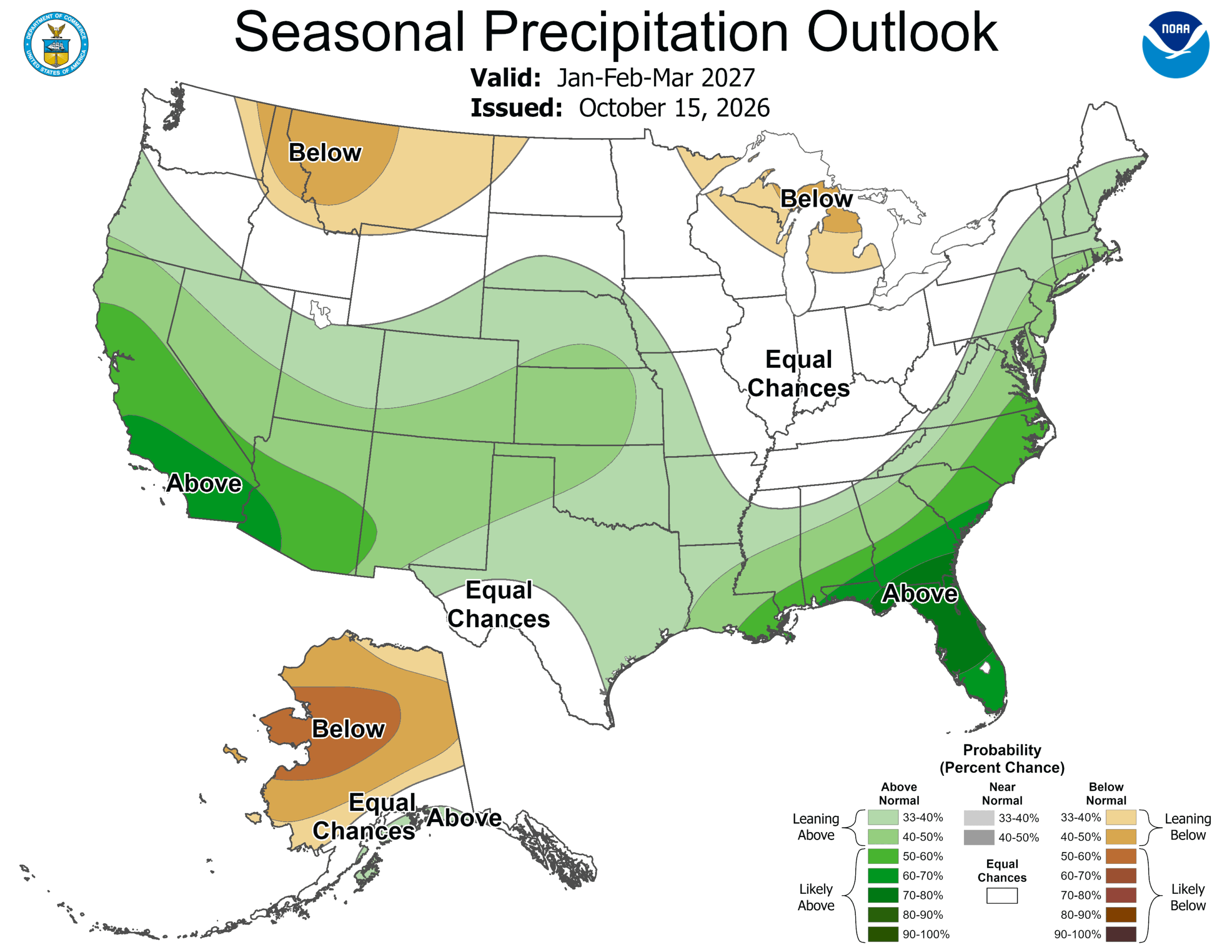
El Niño, which is helping shape the weather pattern, is expected to be persist through winter. The National Oceanic and Atmospheric Administration on Thursday issued its U.S. Winter Outlook, which shows its anticipated influence from December through February.
NOAA’s forecast continues to call for: warmer-than-average temperatures across the northern U.S.; wetter-than-average conditions across the southern U.S., from California to Florida, and along the Eastern Seaboard; and drought conditions improving for most of the country.
Meteorologists blame El Niño and the marine heat wave off the coast of southern California for the warmer temperatures across the West, specifically along and near the California coast, while the weather-changing low-pressure pushing in from the Pacific is a result of the long-term Pacific Decadal Oscillation.
The Kuroshio Marine Heat Wave off the coast of Japan contrasted with the cooler water in the Bering Sea is producing a negative phase of the Pacific decadal oscillation that is helping to bring some upper-level lows into the West, according to AccuWeather.
“This week is an example of one of those low-pressure areas coming in that’s going to basically reverse the flow pattern to onshore and drive in much cooler temperatures,” Merrill said. “Some lower elevation and coastal rain and some high elevation snow will fall in the Mountain West. This weather will help fire crews to contain more of the fires that started during the Santa Ana winds last week. So, a combination of El Niño and the cool phase of the Pacific Decadal Oscillation is helping to drive the weather pattern in California right now.”
Last week’s weather increased fire risk in areas of California.
On Friday, a fast-moving fire burned at least four homes in Southern California, prompting evacuations. The Orange County Fire Authority said four homes burned in the fire.
More than 8,600 residences were without power in San Luis Obispo County as a PG&E shutoff due to high winds. High winds also prompted widespread power outages in areas of the Santa Clarita Valley, Southern California Edison enacted its public safety power shutoff policy to address the high fire danger.