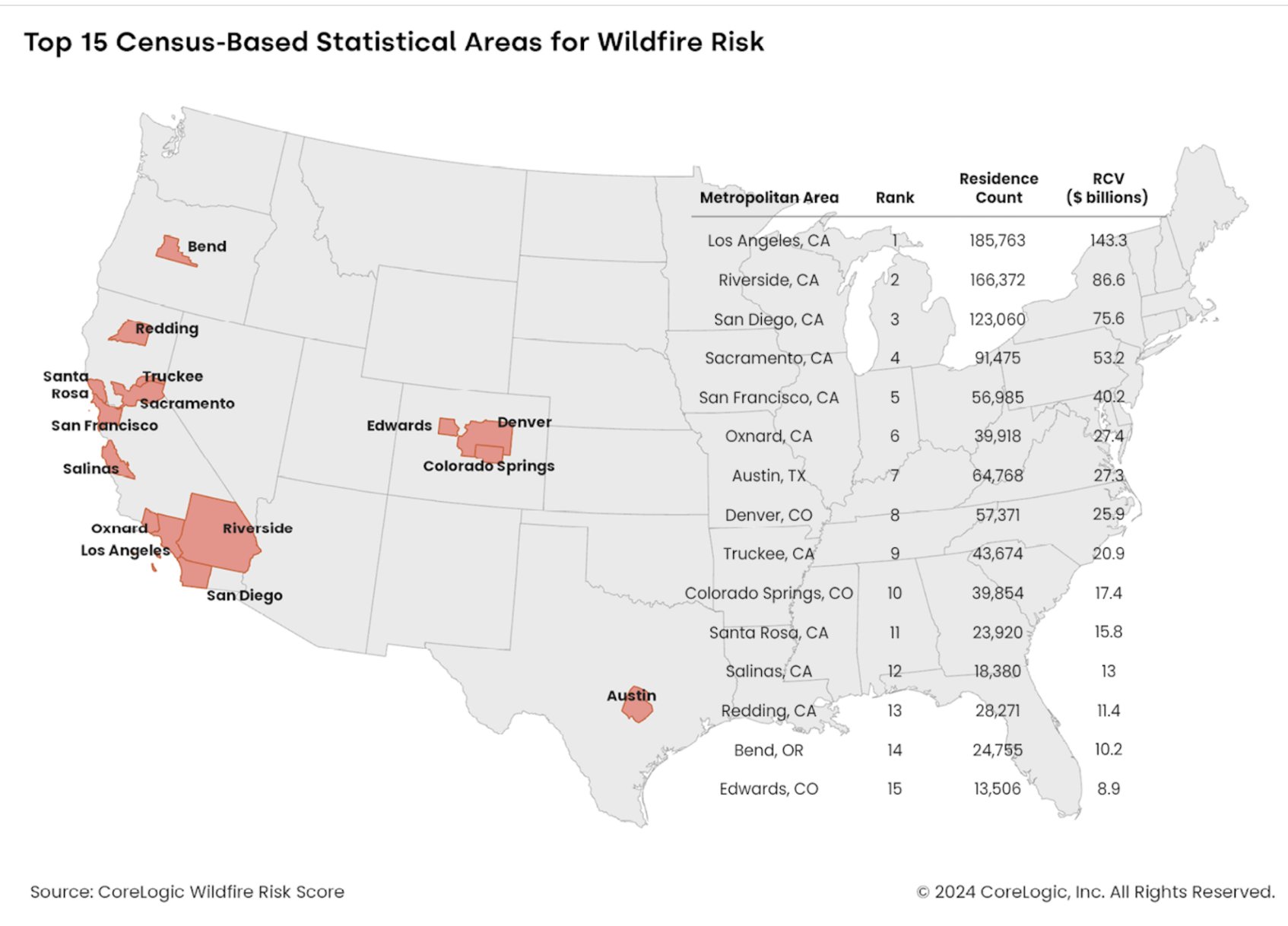
The Top 15 U.S. Metros with High Exposure to Wildfire Risk
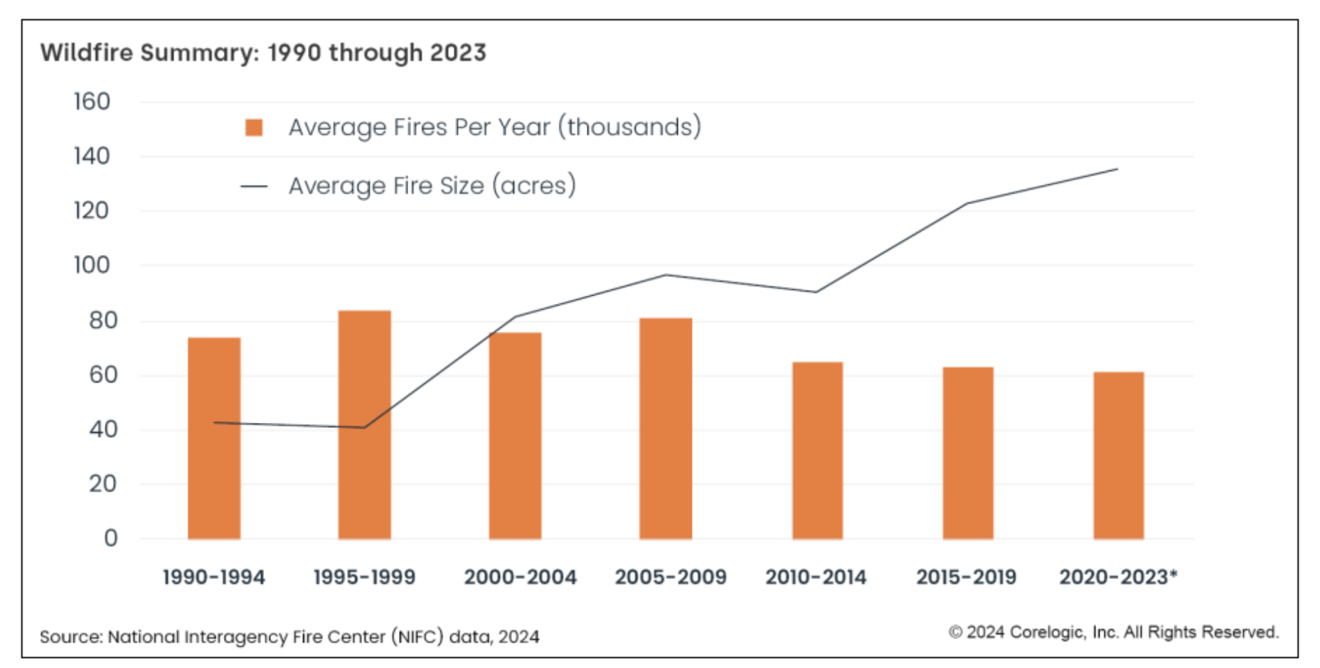
The number of wildfires per year is going down, but the increasing size and intensity of the fires is creating more property damage than ever before – in fact, the average fire size has tripled over the past 30 years, a new analysis shows.
Wildfire activity is cyclical and doesn’t follow a uniform pattern form season to season. In 2023, when an El Niño weather pattern brought increased moisture to the West and South, the U.S. experienced a 25-year low in total area burned. Reports showed 2.7 million acres (4,209 square miles) burned that year from wildfires. In 2022, nearly triple that area burned, with fires touching 7.57 million acres (11,839 square miles).
In the first four months of 2024, 1.75 million acres have burned in the U.S. This is primarily due to the largest fire recorded in Texas history, which scorched more 1 million acres. States lawmakers have faulted a power pole for starting the massive blaze.
CoreLogic conducts an annual analysis of the wildfire hazard by calculating the residential exposure to higher categories of wildfire risk and the reconstruction cost of properties to produce the top 15 core-based statistical areas in the U.S. for wildfire exposure. All the metro areas on the list are in the West, six of which are in California.
Los Angeles tops the list with 185,763 properties at a higher risk and at a reconstruction value of $143.3 billion. The rest of the top five are Riverside (166,372 at $86.6 billion), San Diego (123,060 at $75.6 billion), Sacramento (91,475 at $53.2 billion) and San Francisco (56,985 at $40.2 billion).
The report also notes that many of the high-extreme wildfire risk areas are in states that lead the nation in housing shortages, which means many homes will be built in the wildland-urban interface, raising risks for properties and people alike.
Therefore, the report calls out the need for wildfire education, thoughtful urban planning and development, and wildfire insurance coverage that supports risk mitigation.
There’s also an elevated wildfire risk outside the WUI.
“Even when the division between high-risk areas and development is clearly defined, embers blown from burning vegetation onto and into homes can stretch a fire’s threat farther into the urban zone,” the report states. “Embers are responsible for an estimated 90% of home ignitions caused by wildfire. There have been instances of embers igniting residences up to a half mile or more from an actual fire.”
Photo: Photographer: Kathryn Elsesser/AFP/Getty Images